

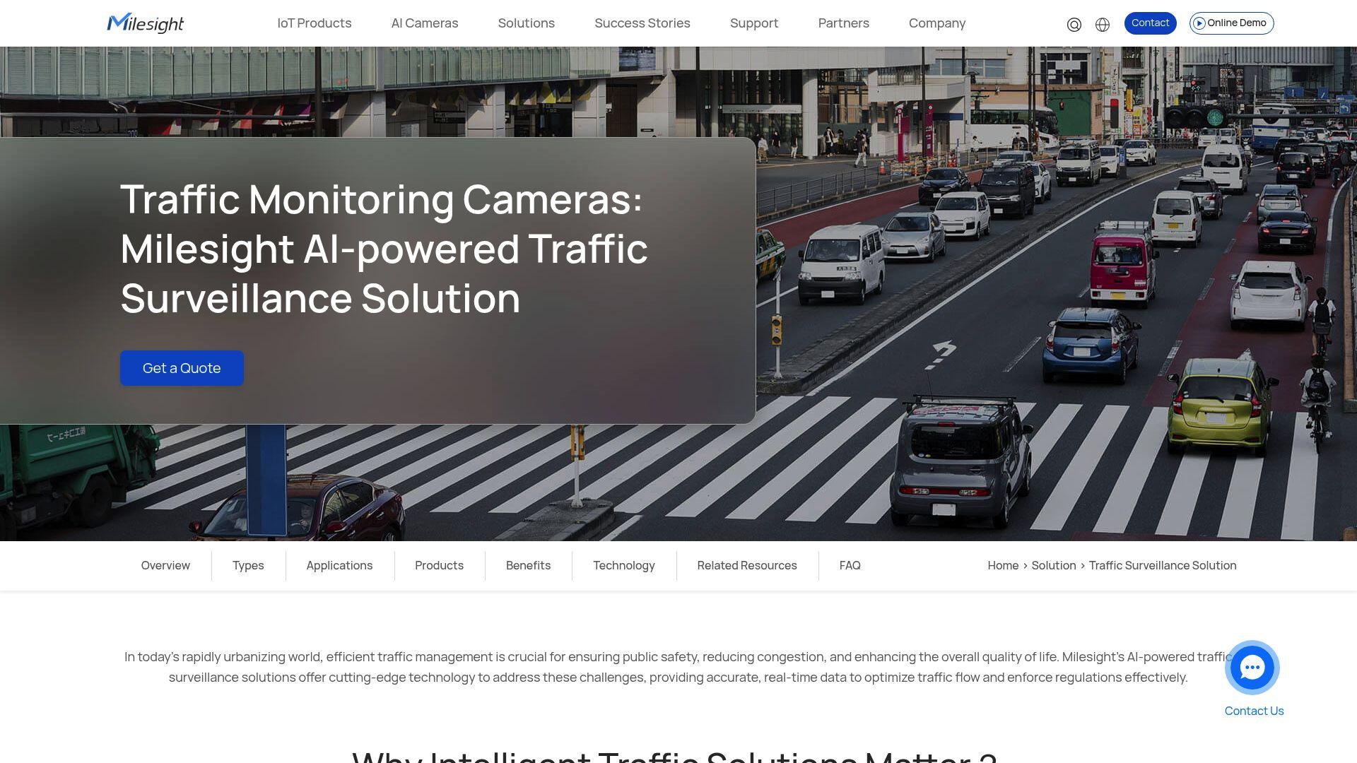
Discover the cutting-edge technologies and AI platforms city planners are deploying to gather accurate traffic insights and architect the safe, connected cities of tomorrow.
| Name | Pros | Cons | Pricing |
|---|---|---|---|
| Miovision |
|
|
Custom / Quote |
| Axis Communications |
|
|
Varies |
| FLIR |
|
|
Varies |
| Adaptive Recognition |
|
|
Custom / Quote |
| Milesight |
|
|
Varies |
| Digi |
|
|
Varies |
Image generated by Gemini
Evaluating Next-Generation Infrastructure Scanners
For decades, urban planners relied on pneumatic rubber hoses stretched across asphalt to count passing vehicles. While functional for basic volume metrics, modern urban environments demand far more sophisticated intelligence. Municipalities face rising congestion, complex multimodal transit interactions, and an urgent need to reduce traffic fatalities. In response, a massive $700 billion infrastructure and artificial intelligence spending boom is fueling the deployment of intelligent mobility technologies. This financial influx empowers city engineers to move beyond mere volume observation and actively predict roadway incidents. Upgrading to portable video sensors and edge-computing platforms provides the high-fidelity insights required for modern city planning.
Recent government initiatives highlight the sheer necessity of this technological transition. Departments of transportation are actively installing updated counting devices on local roads to survey routes that have been untouched for over 20 years. Simultaneously, European cities like Athens are deploying vision-based artificial intelligence systems to monitor specific intersection behaviors. These modern setups analyze real-time variables to control traffic flow and prevent accidents before they occur dynamically. Industry reports indicate that 90 percent of new vehicles currently collect telemetry data, providing an additional layer of macro-level movement intelligence. To navigate this new era of intelligent transportation, local governments must carefully evaluate the latest scanning hardware.
Before analyzing the top hardware providers, city planners must understand the metrics defining modern success in this space. Authorities worldwide are recognizing this need, with the National Road Safety Authority recently introducing digital camera-based monitoring systems to detect high-risk driving behaviors automatically. To combat staggering accident figures, technology must transition from passive observation to active incident prediction. A primary requirement is multimodal classification, enabling systems to accurately distinguish between passenger vehicles, heavy freight, cyclists, and pedestrians. Devices should process video or radar data directly on board to reduce latency and reduce expensive bandwidth costs. This localized processing ensures municipalities receive actionable intelligence rather than raw, unmanageable video files.
Remote connectivity is another non-negotiable feature of modern roadway infrastructure. Deploying personnel to active highways carries significant safety risks that cellular-enabled devices entirely eliminate. Highlighting this shift, recent surveys show that 80 percent of fleet professionals now rely on GPS tracking technology, marking an eleven-point annual increase. Additionally, the adoption of specialized video artificial intelligence has reached a critical 46% among commercial operators. City planners demand similarly sophisticated, auditable, and prosecution-grade data to justify multi-million-dollar civil investments. Robust optical and thermal networks provide the exact ground-truth validation required to optimize municipal traffic signaling.
Top Solutions Modernizing City Streets
Miovision Scout Plus
| Core Technology | Onboard AI Video Processing & Cellular Connectivity |
|---|---|
| Primary Benefit | Eliminates the need for multiple devices; captures multimodal data simultaneously. |
| Target Audience | Traffic Engineers, Municipalities, and DOTs |
| Key Metric | 95% verifiable data accuracy for video studies |
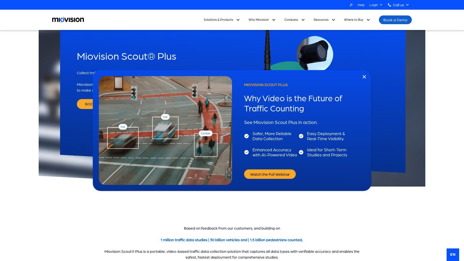
For modern municipalities, securing highly accurate traffic data collection has fundamentally transformed the urban planning process. The Miovision Scout Plus platform is a leader in this shift, offering a highly portable, video-based solution. This system is engineered specifically to replace multiple legacy tools with a single, intelligently connected field device. The company has built a foundation comprising 1 million traffic studies and 30 billion counted vehicles globally. Traffic engineers rely on this robust ecosystem because it delivers an independently verifiable 95 percent data accuracy rate. Users can quickly deploy the ruggedized unit in under ten minutes without requiring extensive technical training.
The primary differentiator of the Scout Plus remains its multimodal versatility combined with powerful onboard edge processing. Engineers no longer need to deploy separate devices for road volume counts, speed analysis, and pedestrian pathway monitoring. In fact, Miovision systems have successfully tracked over 1.5 billion pedestrians, providing unmatched insights into non-vehicular movement. The device uses cellular connectivity to securely process video onboard while identifying near-misses and tracking subtle junction movements. Decision-makers can easily monitor studies and validate results remotely from their office dashboard. This remote management eliminates the hazardous need for field workers to enter live, high-speed roadways repeatedly.
Axis Radar-Video Fusion
| Core Technology | IP-Based Surveillance & Deep Learning Analytics |
|---|---|
| Primary Benefit | Excellent visibility in severe weather and zero-light conditions. |
| Target Audience | Highway Authorities and Critical Infrastructure Managers |
| Key Metric | 18% of annual revenue reinvested into R&D |
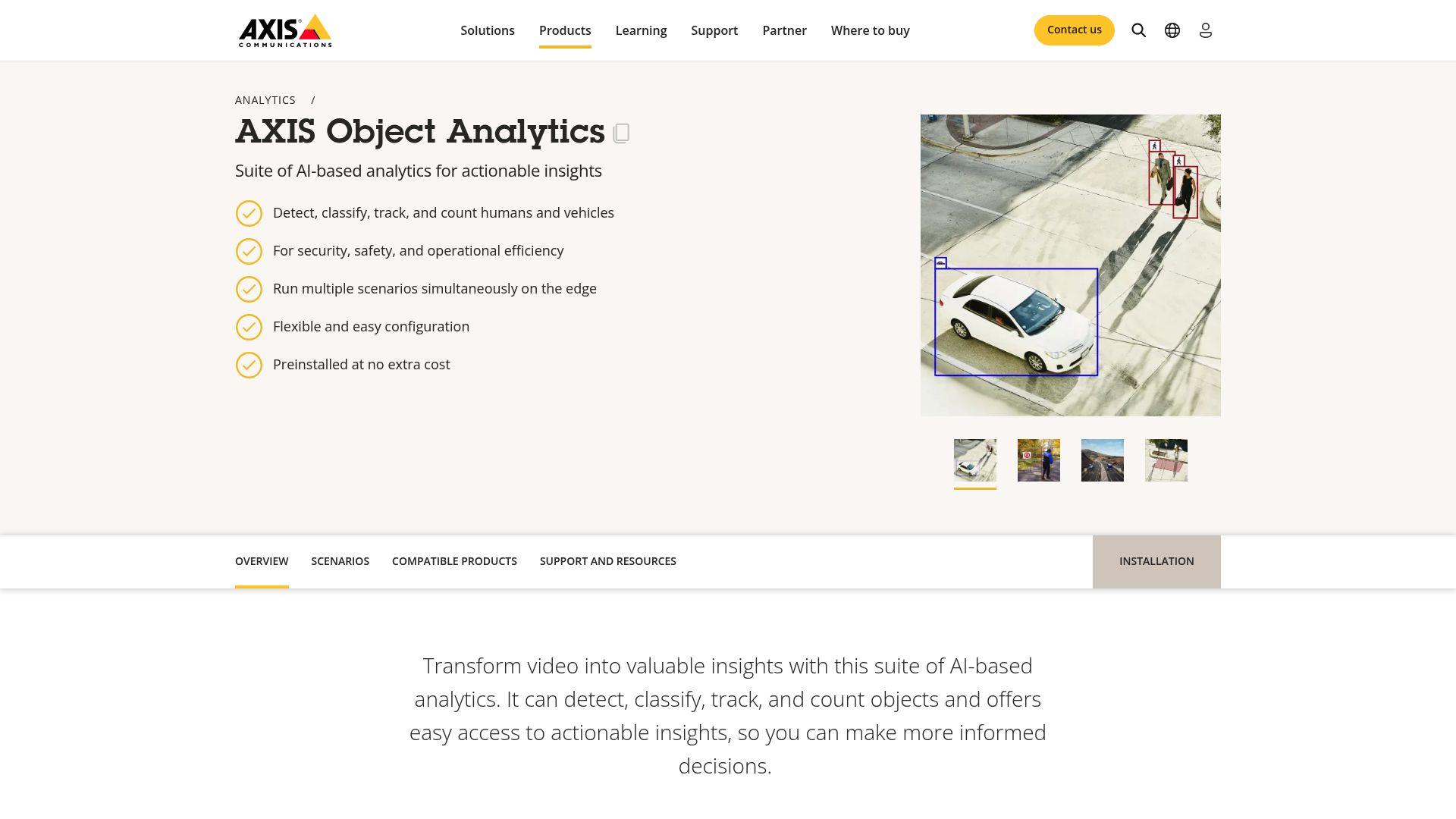
Axis Communications operates as a global pioneer in network video surveillance and Internet Protocol-based security solutions. As a majority-owned subsidiary of Canon (CAJ), the organization utilizes extensive corporate backing to develop robust traffic intelligence. The Swedish manufacturer notably invests approximately 18 percent of its annual revenue directly into research and development. This heavy capital allocation supports nearly two thousand engineers working on deep learning analytics and artificial intelligence integration. Municipalities strongly favor the company’s open platform architecture, which ensures seamless interoperability with third-party city management software. Avoiding vendor lock-in allows local governments to upgrade individual components without overhauling their entire monitoring network.
A standout capability for highway authorities is the brand’s proprietary radar-video fusion technology. This integrated system excels in detecting wrong-way drivers and tracking vehicle speeds during blinding rain or dense fog. Consolidating actionable information requires systems capable of integrating data from over 3,000 fragmented sources into a single risk profile. Capturing those critical safety improvements begins with roadside hardware that can see clearly when human eyes cannot. Supported by proprietary low-light imaging algorithms, Axis cameras maintain excellent visibility throughout the darkest hours of the night. Backed by an industry-leading five-year hardware warranty, these sensors remain a premium choice for fixed-installation critical infrastructure.
FLIR TrafiCam AI
| Core Technology | Thermal Imaging & Wi-Fi MAC Address Tracking |
|---|---|
| Primary Benefit | Macro-level insights into city-wide traffic flow without relying solely on visual optics. |
| Target Audience | Urban Planners and Traffic Control Centers |
| Key Metric | Proven legacy backed by an $8.0 billion corporate acquisition |
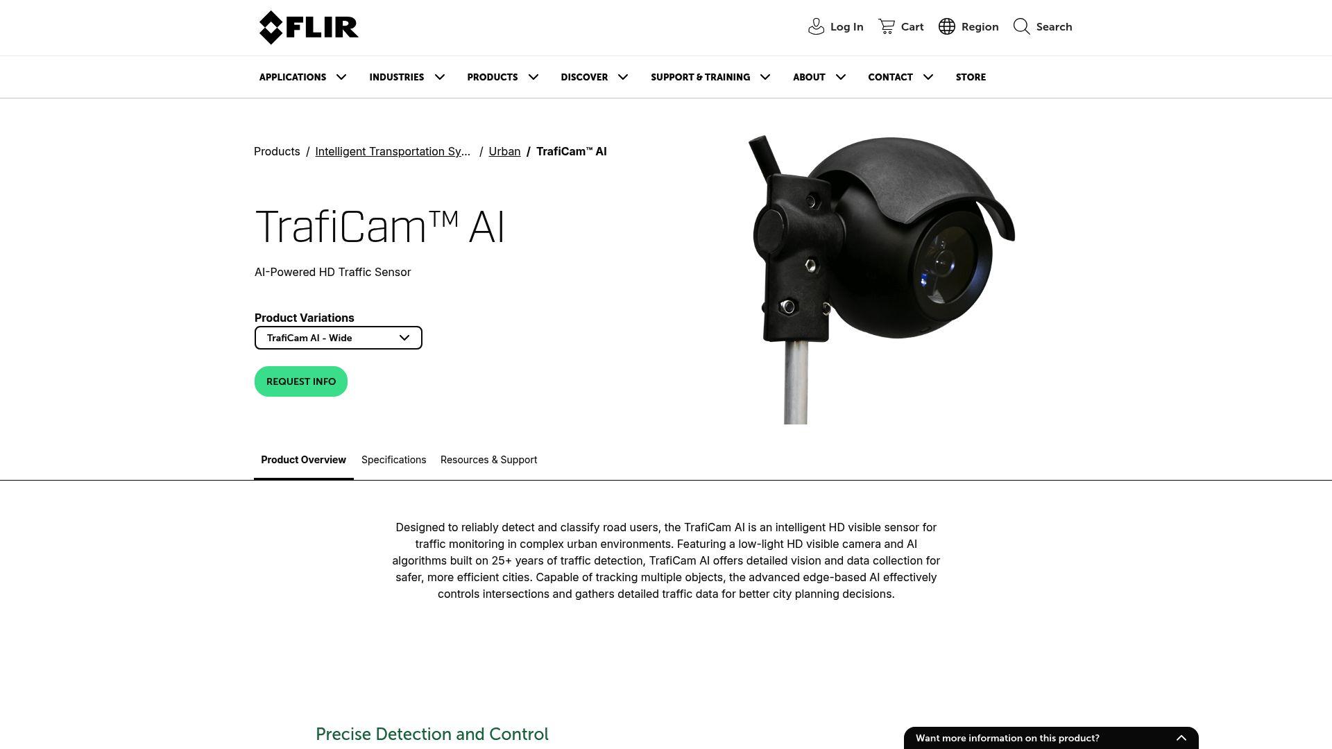
FLIR brings a sixty-year history of infrared innovation to the complex arena of urban mobility. Teledyne Technologies (TDY) acquired the specialized thermal imaging manufacturer for $8.2 billion in an industry-shaping corporate buyout. While traditional optical cameras frequently struggle with intense headlight glare and shifting shadows, thermal sensors bypass these visual limitations entirely. By tracking the distinct heat signatures of passenger vehicles and exposed pedestrians, the hardware ensures absolute round-the-clock visibility. This technology proves exceptionally valuable in environments subject to dense smog, heavy snowfall, or complete electrical grid failures. Traffic control centers rely on these robust thermal feeds to maintain situational awareness during severe localized emergencies.
Modern smart city sensors from FLIR combine this established thermal heritage with advanced algorithmic processing. The TrafiCam AI unit integrates artificial intelligence directly alongside wireless media access control address tracking capabilities. Currently, the NHTSA is reviewing hundreds of automated-driving crash records linked to navigational failures at intersections. Mitigating such risks requires infrastructure that can anonymize and monitor signals from connected devices inside passing cars. FLIR systems accurately calculate travel times and route congestion along major road segments using these invisible wireless handshakes. This dual-layered approach delivers a comprehensive, data-driven picture of traffic flow that standard optical lenses cannot replicate.
Adaptive Recognition Lynet Mobile
| Core Technology | Optical Character Recognition & Carmen ANPR Engine |
|---|---|
| Primary Benefit | Captures court-admissible, prosecution-grade evidence. |
| Target Audience | Law Enforcement, Border Security, and Toll Operators |
| Key Metric | Reads plates and identifiers at speeds up to 320 km/h |
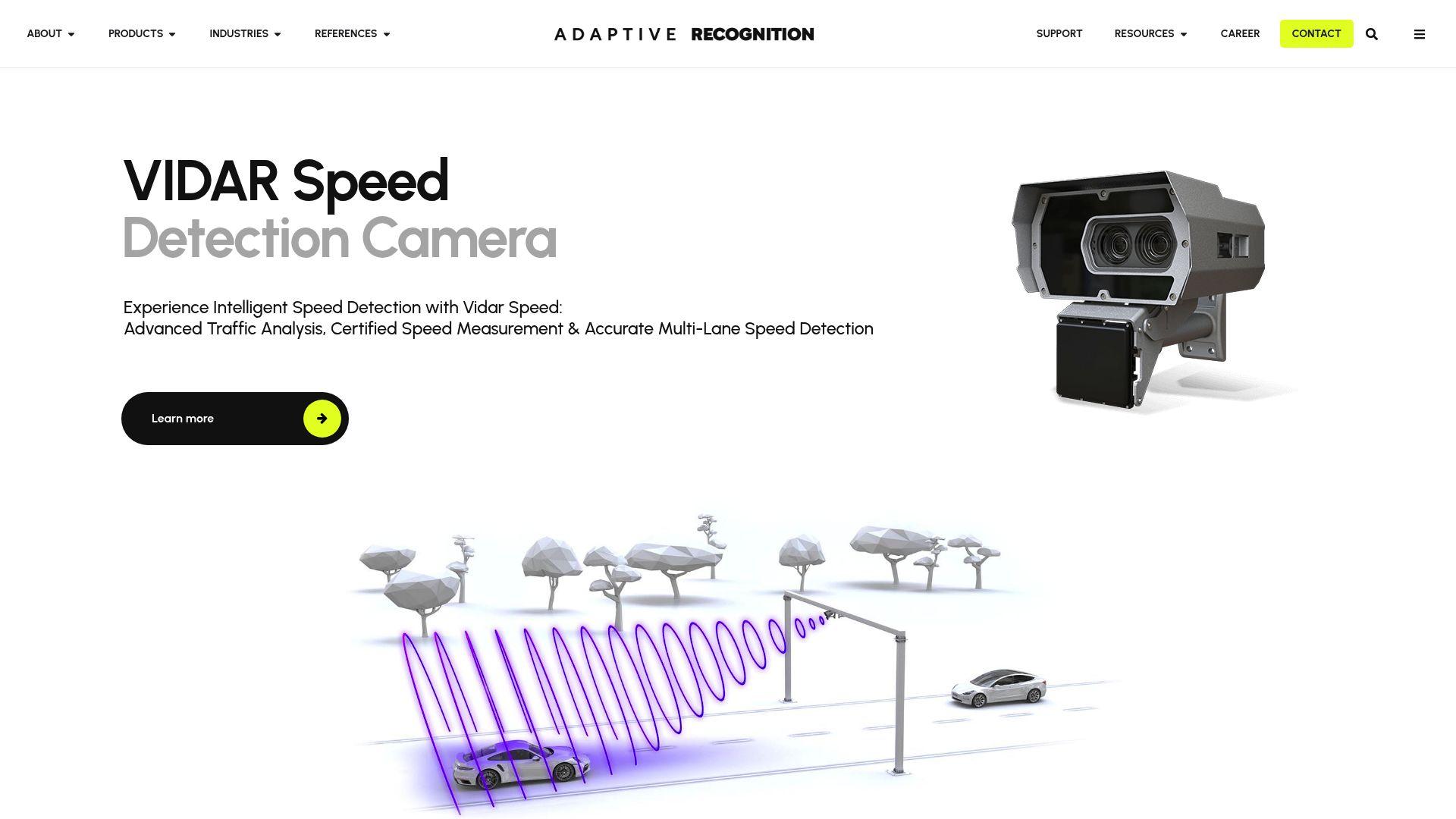
For specialized law enforcement and border security applications, raw volume counting often remains secondary to precise vehicular identification. Adaptive Recognition directly addresses this strict requirement with its highly ruggedized automatic number plate recognition hardware. The Lynet Mobile camera functions as an ultra-compact, passively cooled system powered by a proprietary analytical engine. Built to capture court-admissible evidence, these intelligent sensors can reliably read license plates at staggering speeds up to 320 kilometers per hour. The technology accurately processes identifiers in challenging real-world conditions, including extreme glare, caked dirt, and sharp, angular views. Officers deploy these versatile multilane tools seamlessly across moving patrol vehicles without requiring permanent structural modifications.
Ensuring the legal viability of automated traffic citations requires flawless data security from the moment of capture. The system utilizes unique cryptographic hashes to permanently seal violation data, ensuring it withstands aggressive courtroom scrutiny. Recent security industry analysis shows that a proactive approach to real-time incident detection significantly reduces emergency response times. By integrating make-and-model recognition directly with plate reading, the hardware instantly flags stolen or suspect vehicles. A centralized device management architecture allows municipal IT departments to update multiple field units simultaneously. This streamlined maintenance process cements Adaptive Recognition as a critical asset for complex tolling and speed enforcement networks.
Milesight Intelligent Traffic Camera
| Core Technology | Dual-Vision Radar Fusion |
|---|---|
| Primary Benefit | Blends IoT connectivity with hyper-accurate optical sensors. |
| Target Audience | Commercial Fleet Operators and Smart City IT Departments |
| Key Metric | 99% capture rate and 98% ANPR accuracy within 100ms |
Milesight combines modern Internet of Things connectivity with hyper-accurate optical sensing to generate granular insights into roadway usage. Their intelligent dual-vision cameras process complex vehicular recognition tasks with virtually zero noticeable operational lag. Internal performance testing confirms these optical systems achieve a 99 percent capture rate and 98 percent plate recognition accuracy. Moreover, specialized processing chips finalize this complex identification sequence in an astonishingly brief 100 milliseconds. By utilizing advanced radar fusion, the cameras simultaneously map real-time speed, travel direction, and multilane vehicle classifications. This high-fidelity data feeds directly into smart city dashboards, enabling engineers to optimize signaling cadences dynamically.
Accurate roadside intelligence drastically improves the operational efficiency of heavily burdened commercial logistics fleets. Analysts tracking the transportation sector note that 62 percent of surveyed fleet managers cite reducing operational costs as a primary strategic goal. High-performance hardware provides the exact ground-truth validation necessary to enforce commercial vehicle compliance and routing regulations. Integrating these advanced optical arrays allows municipal technicians to understand the precise structural composition of daily congestion. The continuous stream of reliable intelligence ensures that infrastructure investments target the most severely stressed geographic corridors. Ultimately, this connected approach transforms static video surveillance into an active, automated traffic management ecosystem.
Digi Connect Sensor XRT-M
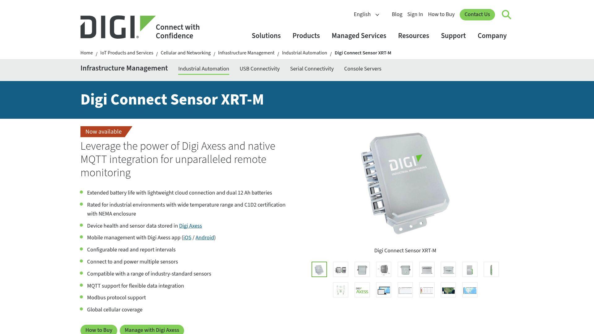
| Core Technology | Cellular Edge-to-Cloud IoT Routing |
|---|---|
| Primary Benefit | Keeps remote infrastructure online and securely managed 24/7. |
| Target Audience | Municipal IT Directors and System Integrators |
| Key Metric | Q3 2023 revenue hit $108 million, driven by a 30% jump in IoT Products ARR |
While sophisticated cameras and radar gather critical surface intelligence, transmitting that heavy data demands enterprise-grade network connectivity. Digi International (NASDAQ: DGII) addresses this vital infrastructure need by manufacturing highly resilient cellular routers and monitoring gateways. Operating as a public entity with a market capitalization of 1.64 billion, the technology firm is a leader in remote device management. Corporate filings reveal that recent third-quarter revenue hit 108 million, driven largely by a 30 percent jump in internet connectivity product subscriptions. Their flagship Connect Sensor line acts as the central nervous system linking isolated roadside hardware to municipal cloud networks. Providing secure, encrypted virtual private network access ensures that traffic management centers never lose sight of their field assets.
For cities investing millions in smart traffic grids, lifecycle assurance and rigorous cybersecurity standards remain absolutely critical. Recent studies indicate that integrating information from thousands of vehicles simultaneously reveals hidden risks in aging metropolitan mobility systems. Digi addresses these systemic vulnerabilities through continuous over-the-air firmware updates and centralized device authentication protocols. The proprietary remote management software empowers administrative teams to troubleshoot offline hardware without dispatching a service truck. This comprehensive edge-to-cloud communication pathway ensures mission-critical analytical sensors remain online during severe weather events. By securing the foundational communication layer, the firm enables urban planners to deploy next-generation intelligent transportation networks safely.
The Data-Driven Future of City Planning
The systematic shift away from analog measurement tools marks a fundamental transformation in public infrastructure management. As automotive telemetry expands, government agencies and private enterprise must collaborate to decipher increasingly complex mobility patterns. According to industry tracking data, customized traffic forecasting tools now enable operational teams to accurately anticipate the cascading impact of sudden lane closures.
Municipalities that actively invest in automated, multimodal edge devices will possess a distinct operational advantage in the coming decade. By securing highly accurate, independently verifiable intelligence, city planners transition from merely reacting to daily gridlock to actively preventing it. “Prioritizing connected, verifiable data collection is the single most effective strategy for eliminating preventable roadway fatalities,” notes a Miovision solutions architect.
Before you allocate public or private capital toward new infrastructure management tools, consider this: the integration of reliable data is the single most critical factor in reducing roadway fatalities. Ensure your chosen platform prioritizes verifiable accuracy, remote connectivity, and comprehensive post-sale support.
Disclaimer: This article is for informational purposes only and should not be considered investment advice. All investors should conduct their own due diligence before making any investment decisions.


